Lost Creek Ridge

With a small window of good weather in the forecast for Tuesday, Kris, Fletcher and I decided to head out to the Mountain Loop Highway to bag some peaks. We met at the Safeway in Kirkland just after 6:00am and headed up I-5 to Arlington and then on to Darrington. I had never entered the Mountain Loop Highway from the north entrance before so it was entirely new territory for me. We arrived at the Lost Creek Ridge Trailhead just before 9:00am and we were hiking shortly after. The trail starts off very mellow, crossing several nearly rotted-out footbridges over small creeks, before heading straight up in a unrelenting series of switchbacks. The trail however, is soft and well padded with pine needles, cones and moss. We make our way up the trail is minimal breaks to shed layers and arrive at Bingley Gap after just over an hour of hiking. We catch our breath here for moment for before heading to the right, up the ridge towards the Glacier Peak Wilderness.
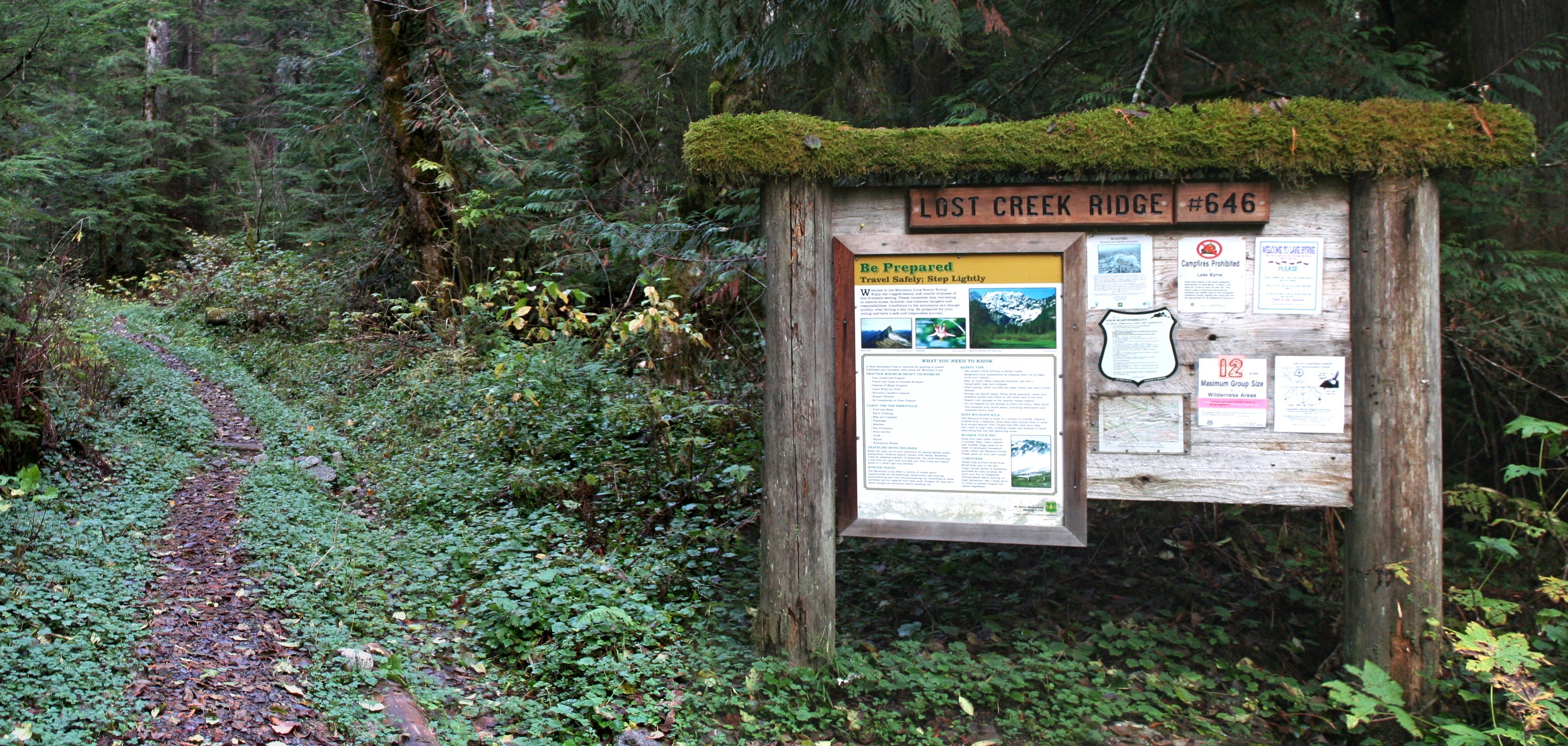
At the Lost Creek Ridge Trailhead.

My first trip into the Glacier Peak Wilderness!
The trail now offered peek-a-boo views of Mount Pugh, Sloan Peak, Bedal Peak, and the rest of the Mountain Loop Highways summits. We meander in and out of the tree cover along the ridge before finally breaking out on the open slopes below Breccia Peak. Glacier Peak and Black Mountain now become the center of attention and the wilderness’ namesake pokes its head out from behind the next valley. New snow has fallen on the volcano since I last saw it on my overnight stay to Tuck and Robin Lakes with Leah. The glaciers look a lot more impressive this close and the bare, dirty slopes of the summer months are now covered in white. We stop for a second at an improvised campsite (which had a campfire ring; naughty, naughty) and glanced up the spur trail to Breccia Peak.

Mount Pugh from the trail just above Bingley Gap.

Glimpses of the glacier on the imposing north face of Sloan Peak.

Sloan, Bedal, Del Campo, Morning Star, Sperry, Vesper
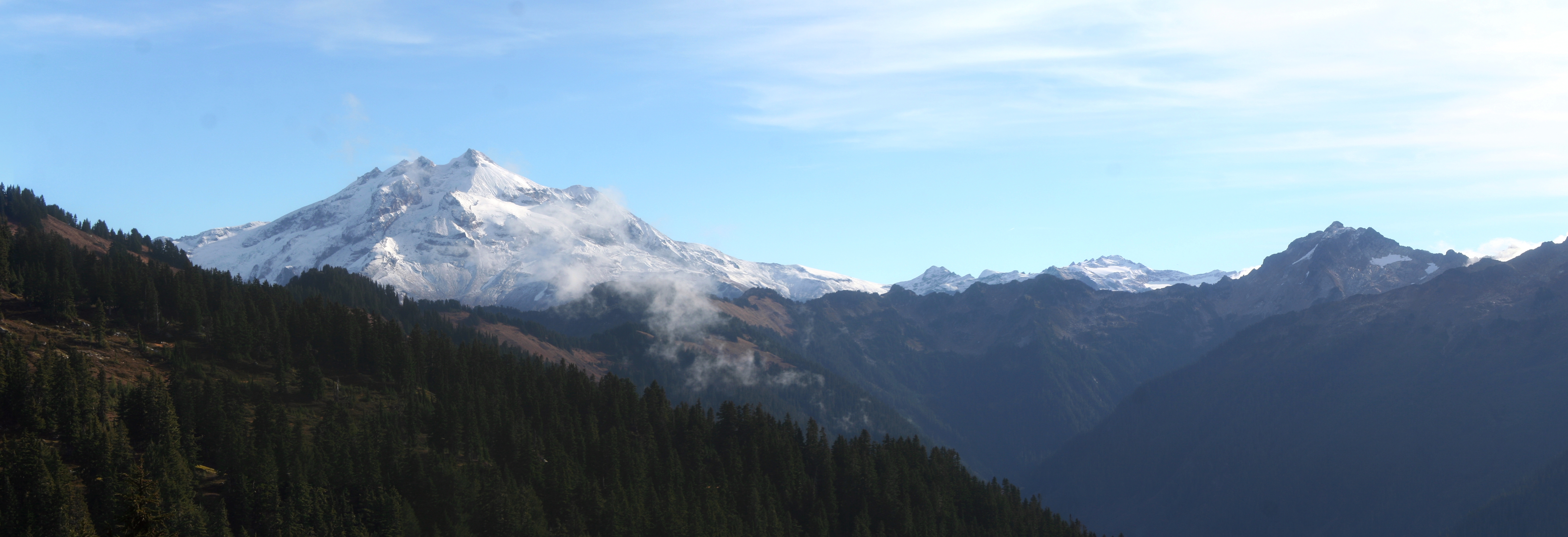
First views of the volcano.
Our goal today was to bag both Breccia and Zi iob Peak but we had decided to first head for Zi iob since it was a bit further along Lost Creek Ridge. Zi iob, according to information on Summitpost.org, takes its name from the native Sauk Indians and means “mysterious people”. We took turns trying to pronounce the peak on our journey along the ridge, I’m kind of partial to “Zy Yob” but I could be totally wrong. After about a mile or two of traversing the ridge the trail begins to dramatically lose elevation and so we decided this was the place to begin our ascent.
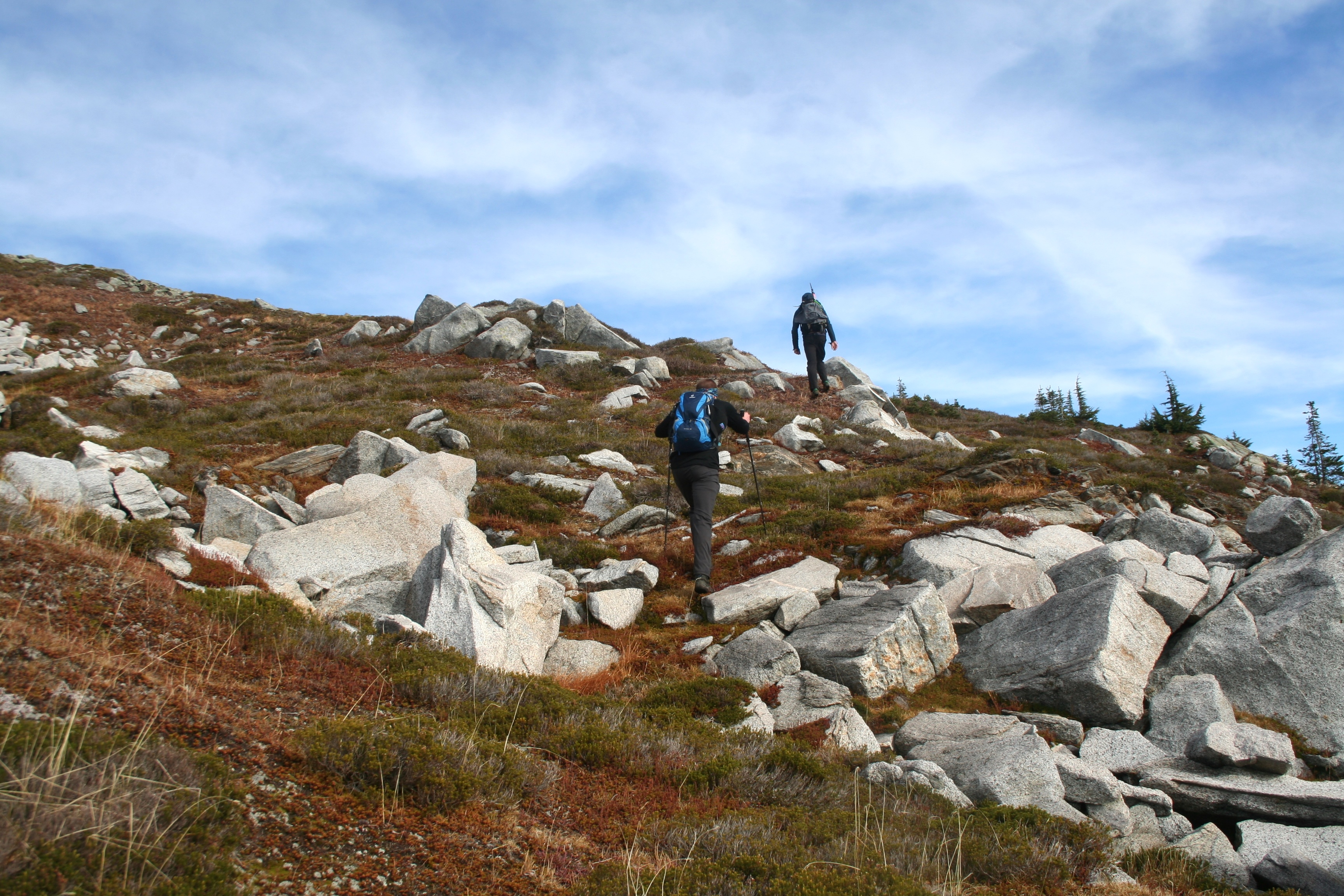
Leaving the Lost Creek Ridge Trail towards Zi iob Peak.

A possible seismographic sensor on the shoulder of Zi iob.
We chose a slick creek drainage as our route up towards the top of Zi iob. The footing wasn’t too great but it soon gave way to heather and evergreen trees with some obvious boot marks from previous travelers. A trip report that I read mentioned a strange green obelisk resting on the shoulder of the mountain and I was very curious to see it for myself, but when we crested the false summit the monolith had been replaced with a boring gray box with a solar panel tower. The object appeared to be setup to record seismic activity and with us being so close to Glacier Peak I’m sure it has something to do with monitoring the volcano. After inspecting the device and watching Air Force fighters swoop across the sky at high altitude, we pushed on the short distance to the summit.

Summit of Zi iob Peak 6,343 ft.

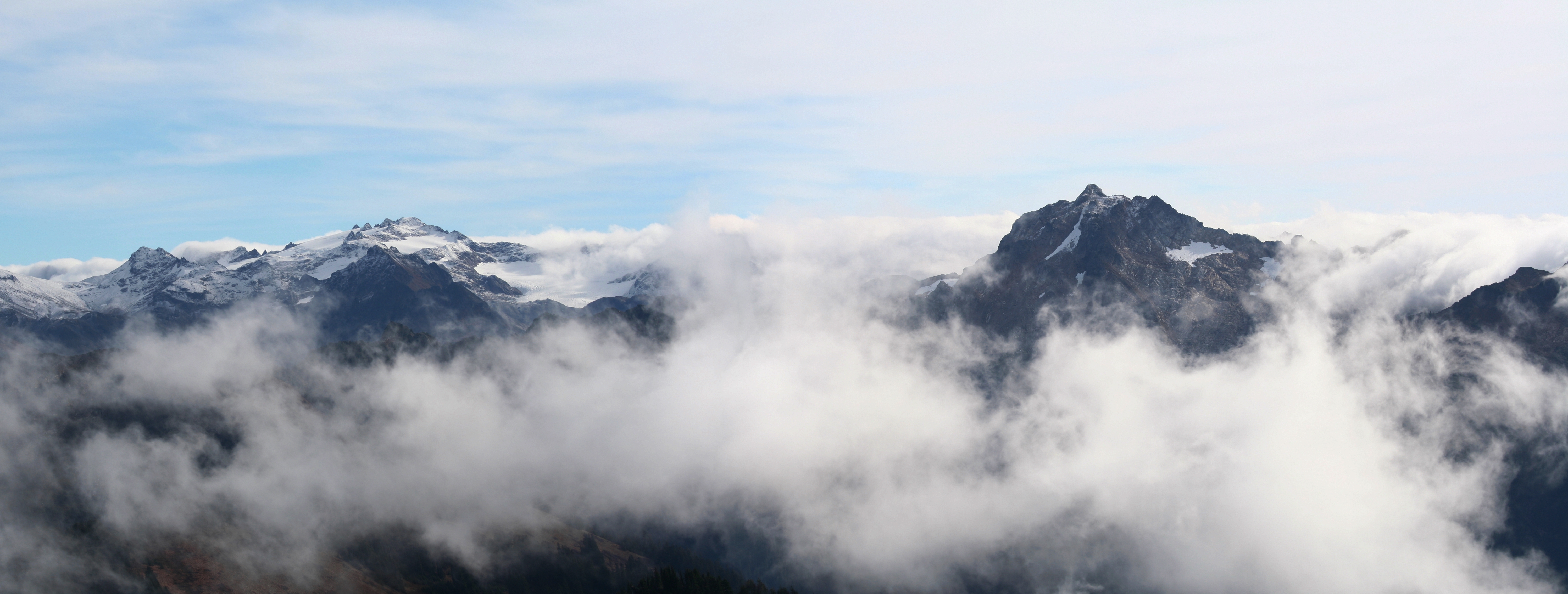
A North Cascades Panorama

Glacier Peak from the summit of Zi iob Peak.
Kololo Peaks and Black Mountain

El Dorado, Forbidden, Sahale, Buckner

Kris on the summit of Zi iob.

White Chuck and Twin Sisters
The summit was large and flat with some evidence of perhaps another tower that has since been taken down. Large boulders gave us some shelter from the wind which had really picked up once we rained the final ridge. Glacier Peak is in your face now, as is Bonanza, Dome, El Dorado, Shuksan, Baker, and many more classic Cascade peaks. I could have spent hours up there taking pictures but the driving wind was getting to be too much to handle so we packed up our lunch and headed West towards Breccia Peak.

Fletcher and Kris heading down the western flanks of Zi iob.
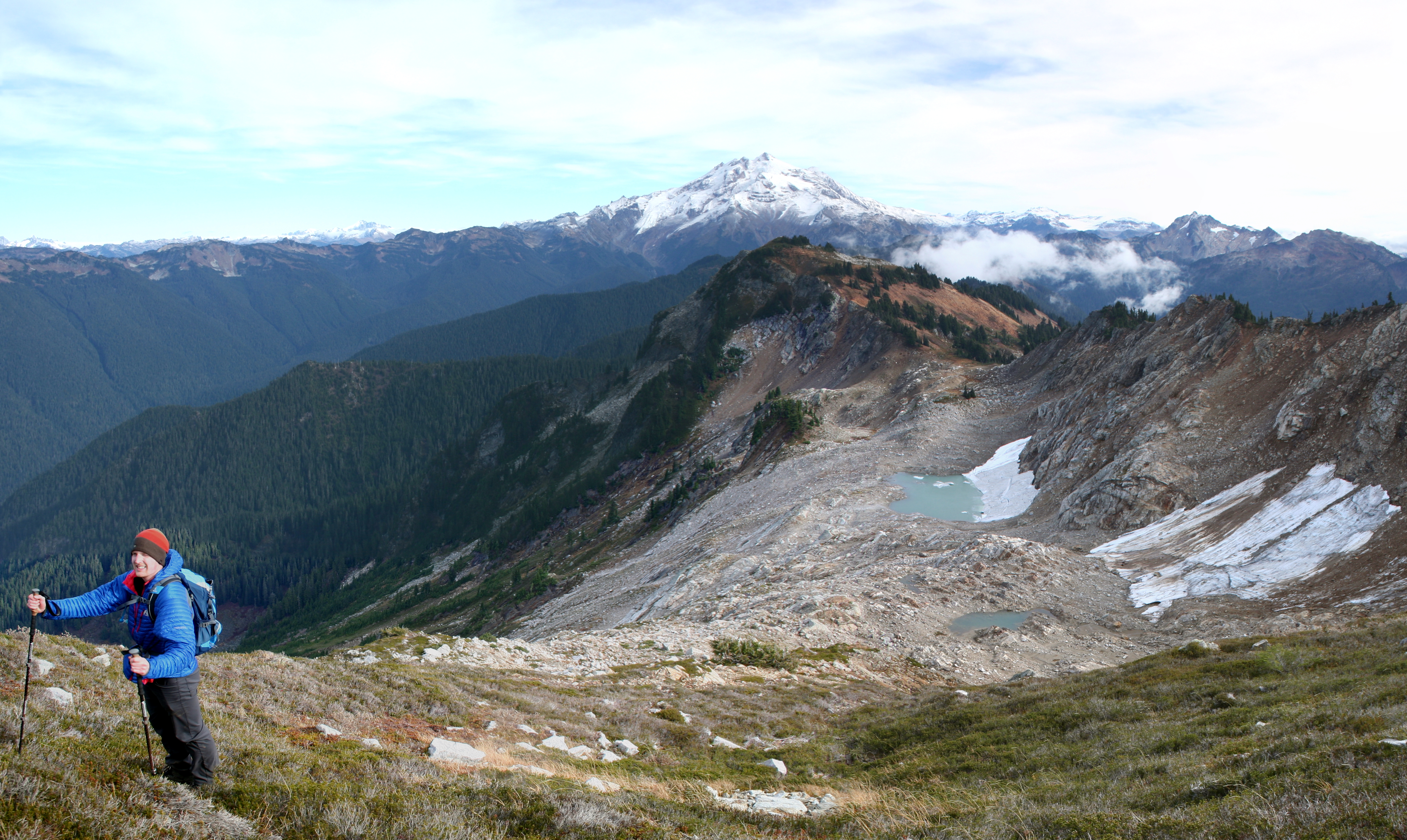
The connecting ridge between the two mountains looked much more direct then going back the way we came so we decided to head cross country towards Breccia. We skirted a small cliff band before dropping down onto the flat, glacially carved area below the upper mountain. A small glacier could have still been active here; perhaps even ten years ago. But now the remaining snowfield has melted its way down the bowl, forming a murky, half frozen lake. We tossed some rocks into the ice and watched the strange bubbles try to find there way out from under the ice. Passing over the outlet, we headed up the boulder field to a small knoll. A short section of Class 2 scrambling brought us to a open heather field and the final steps up to the summit. The highpoint of the mountain is a gentle hill surrounded by craggy spires and towers overlooking Round Lake. We stayed on the summit for a few minutes as the clouds moved in on us. The views from the summit are much the same as Zi iob Peak but offer slightly more in-depth views of the distance North Cascades peaks, revealing ever-so-slightly more of their glaciers and bare granite.

Hiking the flat, glacially carved bench under Breccia Peak. White Chuck, Baker, and Shuksan in the distance.
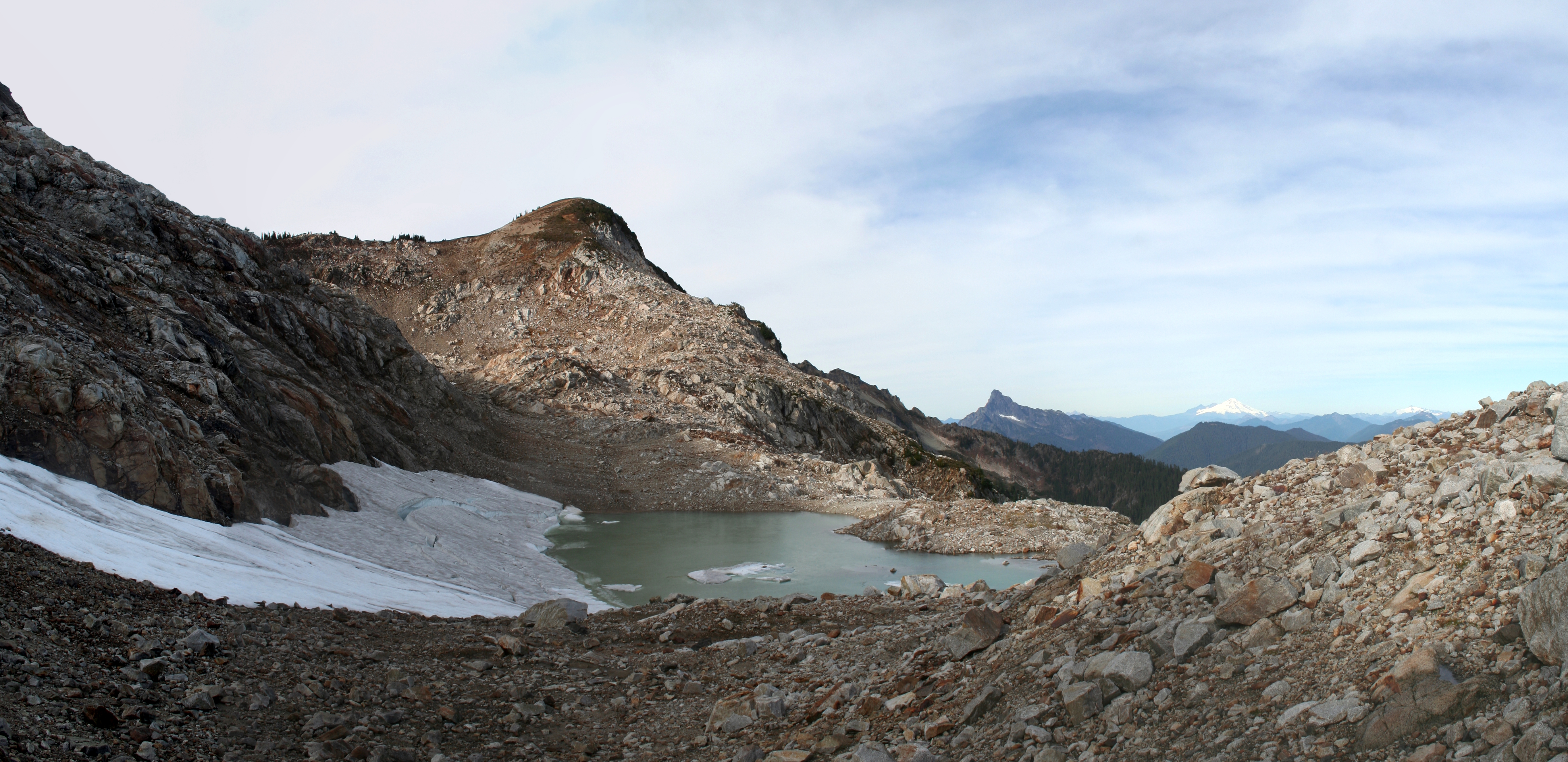
The quickly melting snowfield on Breccia has created a small lake.
Looking back down the scramble from Zi iob Peak. Kris on the heather slopes below the top of Breccia Peak.

Summit of Breccia Peak 6,487 ft.
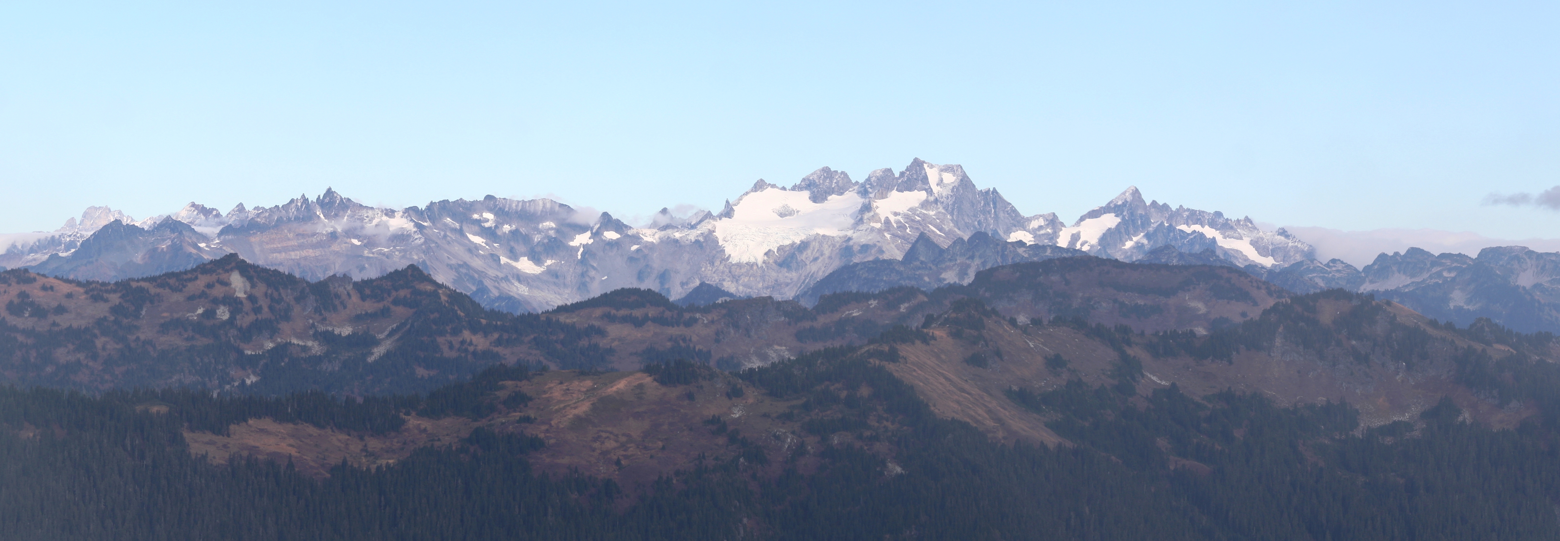
Spire Point, Dome Peak, Sinister Peak

Bonanza Peak

Fletcher in the clouds looking down the south face of Breccia.
After another round of pictures we made our way down the open South slopes of the mountain, tip toed our way across a narrower ridge, and then linked a series of gullies and bowls back down to Sunup Lake. Sunup is a small, oversized tarn on the southern flanks of Breccia, just above the fire-bug campers pad. The slick gully made for some slow going but it was relatively short.

Kris and Fletcher heading down to the southern flanks of Breccia.
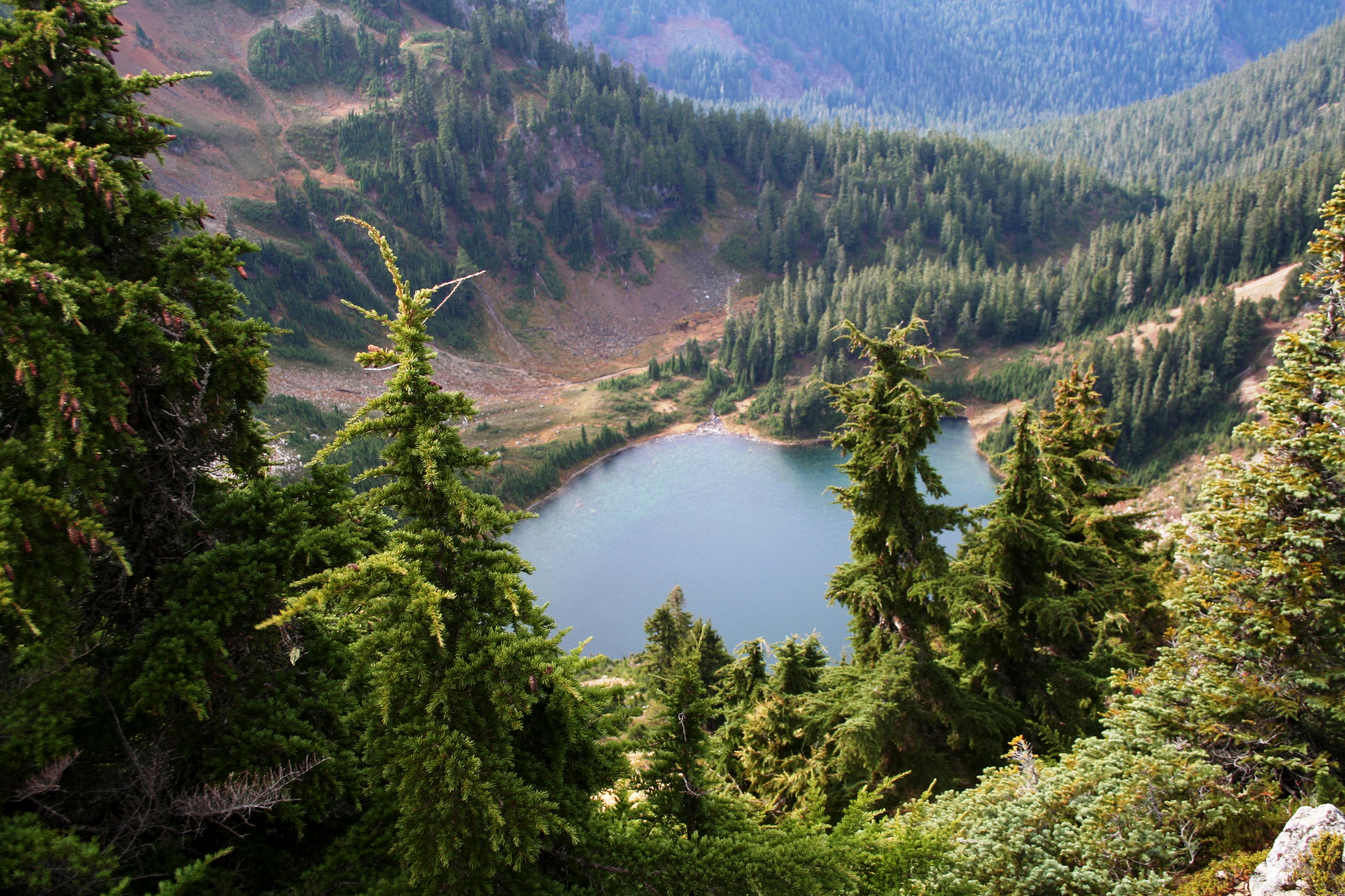
Looking down on Round Lake from the ridge.

Descending a mossy gully to Sunup Lake
Once back on the Lost Creek Ridge Trail we made great time getting back to Bingley Gap. Shortly before the gap we turned off on the spur trail to Round Lake so that we could get a better view of our second mountain of the day. It’s always nice to look back up at what you’ve accomplished and pat yourself on the back. After the final picture op of the trip we blasted down the switchbacks back to the car, arriving just after 6:00pm. We were on the go for about 9 hours, covering roughly 15 miles and about 5,000 feet of elevation gain.

Breccia Peak above Round Lake.
